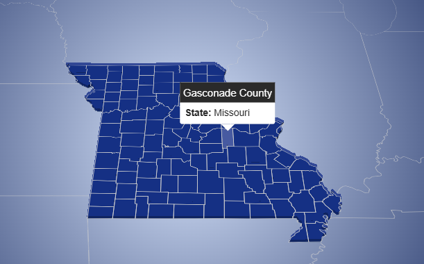
This interactive map visualizes administrative divisions of the United States, including all states and their respective counties. The application is
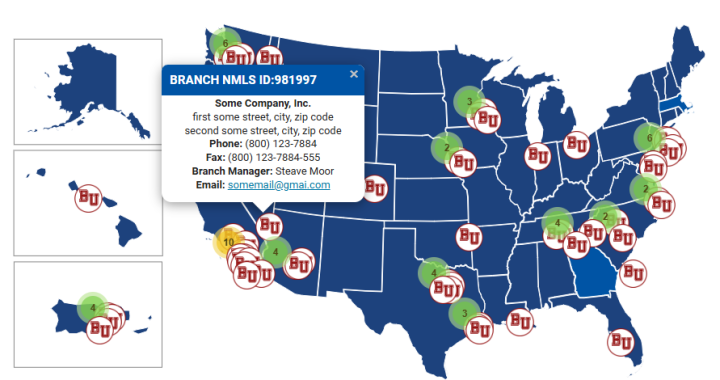
Interactive Map of Company Branch Managers
This project is an interactive web-based map that visualizes the geographic locations of branch managers for a U.S.-based company. The
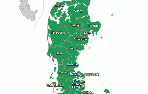
Interactive Map of Historical Administrative Units of Jutland (Denmark)
Technologies: Main Functionality: Map Content Description: This interactive map represents the historical administrative units of Jutland (Denmark). It includes names

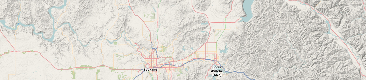
Route Map with directions service
Description: Route Map with directions service created using Google Maps JavaScript API. Demo 1: Demo 2: