
Overview
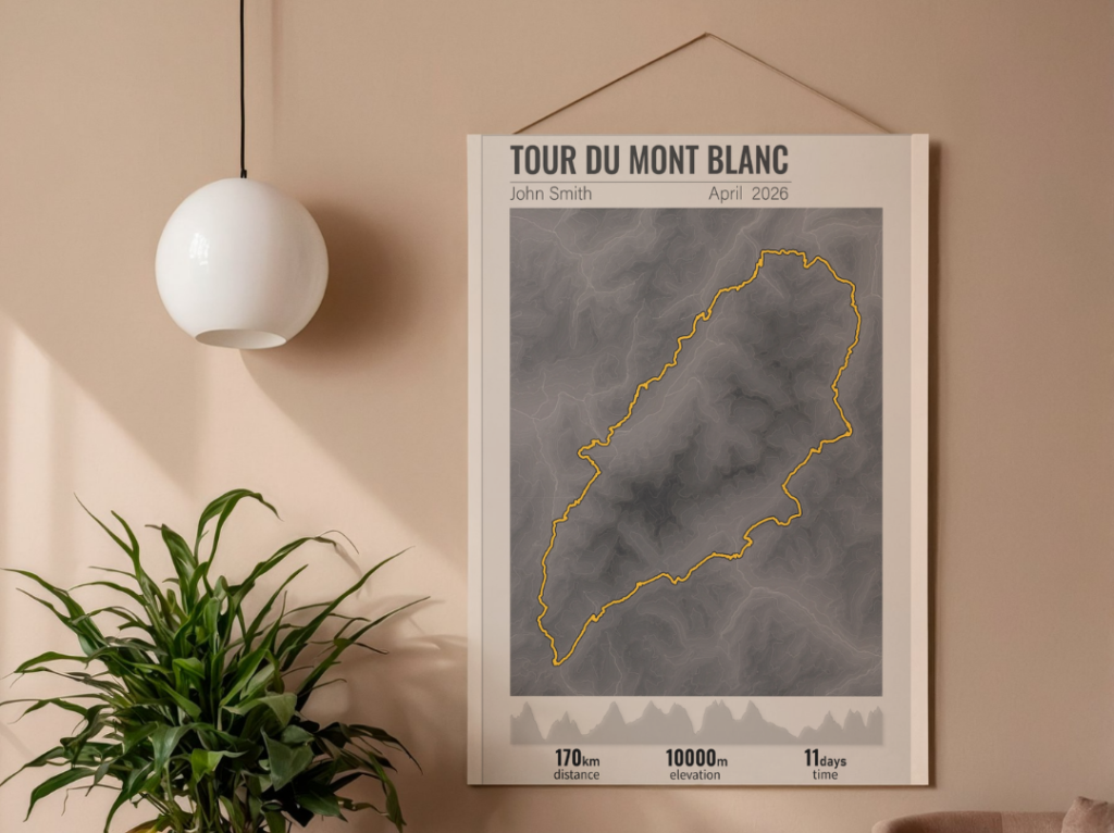
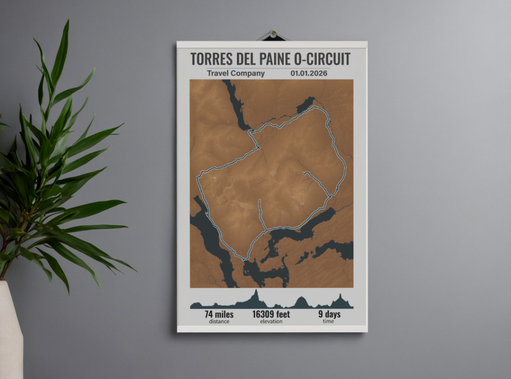
This project showcases the creation of high-quality, large-format (A1) cartographic posters designed for outdoor enthusiasts. Featuring two of the world’s most iconic trekking routes — the grueling Torres del Paine O-Circuit in Patagonia and the breathtaking Tour du Mont Blanc in the Alps — these posters serve as both functional spatial art and a meaningful keepsake for hikers.
The core concept is to offer personalized, modern wall art for hikers who want to commemorate their achievements. Each poster blends precise geographical data with minimalist design, featuring the route, an elevation profile, and customizable traveler statistics.
Live Demo
Key Features
- High-Precision Cartography: Built using actual GPX tracks and high-resolution digital elevation models (DEM) for maximum geographic accuracy.
- Stunning Relief Visualization: Combines custom-blended hillshading with clean contour lines to give the mountainous terrain a tangible, 3D feel.
- Elevation Profiles: Includes an integrated, stylized elevation chart showing the journey’s ups and downs, stage by stage.
- Customizable Traveler Stats: Features personalized sections for the hiker’s name, trek dates, total duration, and cumulative elevation gain/loss.
- Print-Ready Quality: Optimized for crisp, large-format A1 printing, ideal for framing and interior design.
Technology Stack
- GIS & Data Processing: QGIS (Quantum GIS)
- Vector Graphic Design: Adobe Illustrator
- Data Sources: NASA SRTM (DEM), OpenStreetMap (Hydrography & Water bodies), and verified GPX trail logs.
Data Workflow
The creation process was split into two main phases: technical GIS analysis and graphic styling.
1. GIS Processing (QGIS)
- Terrain Modeling: Imported SRTM digital elevation data to generate precise contour lines and a smooth hillshade (відмивка рельєфу) base to highlight the mountain topography.
- Hydrography & Infrastructure: Extracted vector layers for lakes, rivers, and major water bodies from OpenStreetMap data using targeted queries.
- Track Integration: Imported the official GPX routes, projecting them accurately over the terrain and generating the corresponding elevation profile data.
2. Design & Post-Processing (Adobe Illustrator)
- Polishing & Aesthetics: Exported the GIS layers into vector format and brought them into Illustrator to clean up the layout, optimize SVG paths, and apply a modern, sophisticated color palette.
- Typography & Data Layout: Designed a clean typographic hierarchy for the title, route highlights, and stats block.
- Personalization: Added fictional traveler names, dates, and realistic duration/elevation metrics to demonstrate the bespoke nature of the posters.
- Final Export: Prepared the files as high-resolution raster images tailored perfectly for professional A1 print specs.
Result
The final deliverables are two stunning, minimalist A1 posters that look equally at home in a modern living room or a rustic mountain cabin. The contrast between the detailed topography and the clean design elements perfectly captures the spirit of adventure.
Get a Similar Map
Did you recently conquer an unforgettable trail? Whether it’s the Pacific Crest Trail, the Camino de Santiago, or your own local favorite hike, I can turn your personal GPX data into a premium, custom-designed map poster.
You can personalize the colors, fonts, and individual stats (dates, times, and names) to create the ultimate memory of your journey.