This project is an interactive web-based map that visualizes the geographic locations of branch managers for a U.S.-based company. The map is implemented using Leaflet.js, a lightweight and open-source JavaScript library for mobile-friendly interactive maps. It also incorporates the Leaflet.markercluster plugin to efficiently handle large numbers of markers through clustering.
Technologies Used
- Leaflet.js for map rendering and interaction
- Leaflet.markercluster for marker clustering
- SVG Overlay for custom map background
- HTML, CSS, JavaScript
Key Features
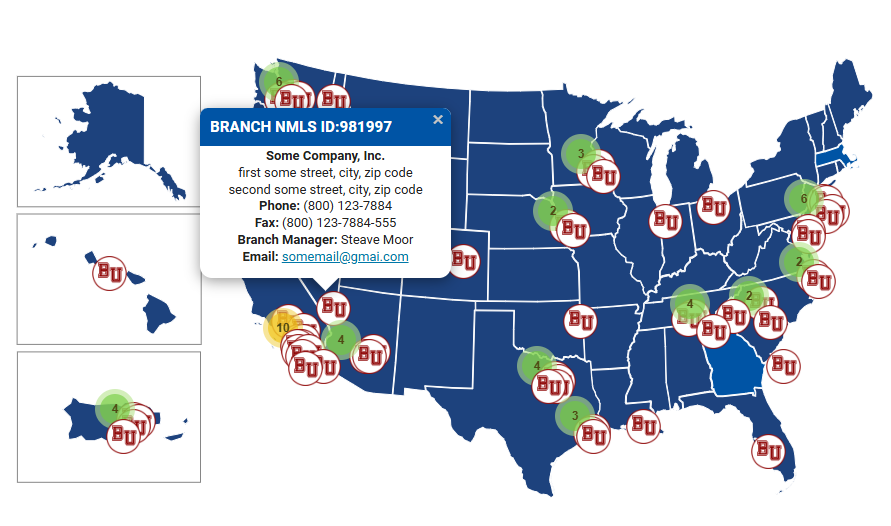
- Custom SVG Background: The map uses a static SVG image as the base layer, offering full design flexibility and control over the background visualization.
- Interactive Markers: Each marker on the map represents a branch manager and includes a popup with detailed contact information such as name, address, phone, fax, and email.
- Clustering Functionality: At lower zoom levels, markers are grouped into clusters to improve performance and user experience. Clustering is disabled at higher zoom levels to show individual markers.
- Responsive Design: The map adapts to different screen sizes using a full-width layout and scalable vector graphics.
Map Content
The map displays the locations of company branch managers, each tagged with contact details and a unique branch NMLS ID. It serves as a visual tool for both internal and external users to identify and connect with specific managers based on geographic location.
If you are interested in collaborating or have any questions, you can contact me on this page – Contact me